We woke up today to a bit of rain. After double checking that our raingear was thoroughly packed, we made our way over to Guil and Lydia’s to prepare our field lunch and down a hearty breakfast. While letting the rain subside, we gathered together to learn a quick overview of rocks (if one exists). With a guest lecture from our new accomplice Darren Gravley, a professor at the University of Canterbury in Christchurch, New Zealand, we learned the difference between felsic and mafic igneous rocks, the components of magma, and how viscosity and volatiles affect the processes of volcanic eruptions. After this, it was time to head into the field.

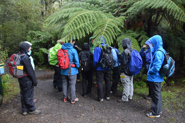
We all packed into the van and “Soob” for a scenic hour-long drive towards the southwest of our temporary home in Ohope, to Tarawera falls. Though the rain continued, we were no less excited to start our hike led by Darren. During this hike we learned how hydrology, ecology, and geology all interact with one another. Though unrelated to geology, the most important takeaway for some of us was that our “raingear” was less waterproof than previously suspected.

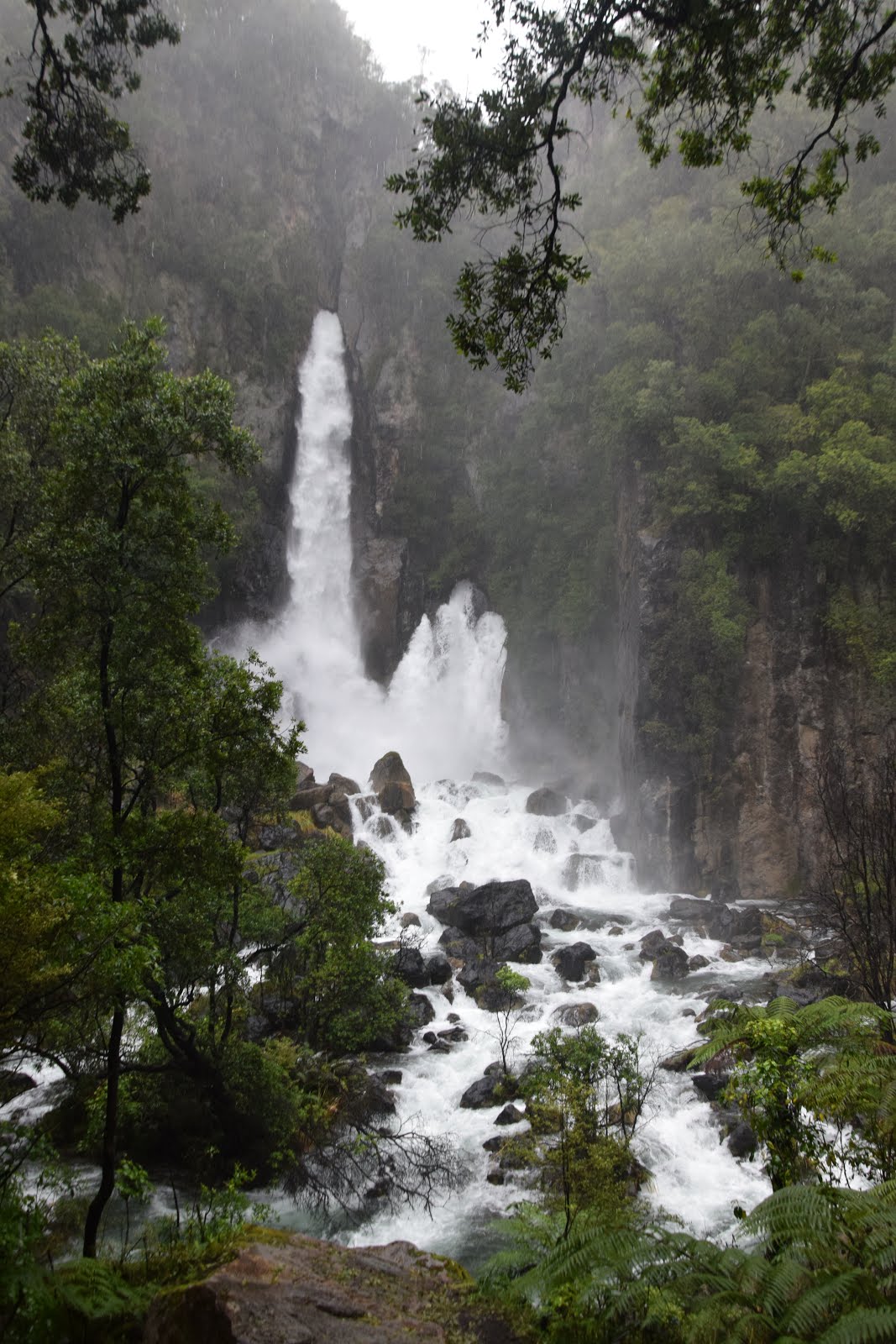
Along the hike, we discussed how large volcanic, car-sized boulders along the trail had been deposited. The conclusion Darren guided us to is that after the eruption of a nearby volcano, the river we were hiking along was dammed by the rock debris, causing an eventual debris flow when the dam burst. This flood of rock and water was strong enough to carry these massive rocks and deposit them further downstream. As we made our way to the waterfall, we observed also that Tarawera falls originated from a system of underground rivers. A wet hike cliffside led us to the sources of these underground rivers: areas of the upper river which looked like bathtub drains of spiraling water, maneuvering their way through cracks in the rock. Before heading down, Darren treated us to one last detour. Three at a time we peered over the precipice of the waterfall, a view that we’ll certainly not forget. With a welcomed break in the rainfall, a trail lined with New Zealand’s famed silver ferns guided us back to our rides.
Back at the holiday park, we gathered for one last lab of the day. For a quick break, the lab was preceded by an important New Zealand ritual: The Tim-Tam SlamÓ! Despite any oddities in the name, this is a family-friendly, tasty, and chocolate-y time. Collaboratively we began our exploration of plate tectonics with four complementary maps of the globe, representing geography, geochronology, volcanology, and seismology. We discussed what each of these maps indicates about the tectonic makeup of Earth. Simple questions like “where is the crust thickest on the Earth?” led to passionate and lengthy discussion by Guil and co. on topics ranging from why ocean crust is more mafic, to the two-stage creation of continental crust, and a lesson on the types of seismic waves.
Feeling weathered but uplifted by the advancements in our geologic knowledge, we took the vans out to a nice nearby group dinner before resting into our rooms. With so many eye-opening experiences, we’re excited for what’s ahead tomorrow!
Goodnight, and stay dry,
Jagger and Reid

We all packed into the van and “Soob” for a scenic hour-long drive towards the southwest of our temporary home in Ohope, to Tarawera falls. Though the rain continued, we were no less excited to start our hike led by Darren. During this hike we learned how hydrology, ecology, and geology all interact with one another. Though unrelated to geology, the most important takeaway for some of us was that our “raingear” was less waterproof than previously suspected.

Along the hike, we discussed how large volcanic, car-sized boulders along the trail had been deposited. The conclusion Darren guided us to is that after the eruption of a nearby volcano, the river we were hiking along was dammed by the rock debris, causing an eventual debris flow when the dam burst. This flood of rock and water was strong enough to carry these massive rocks and deposit them further downstream. As we made our way to the waterfall, we observed also that Tarawera falls originated from a system of underground rivers. A wet hike cliffside led us to the sources of these underground rivers: areas of the upper river which looked like bathtub drains of spiraling water, maneuvering their way through cracks in the rock. Before heading down, Darren treated us to one last detour. Three at a time we peered over the precipice of the waterfall, a view that we’ll certainly not forget. With a welcomed break in the rainfall, a trail lined with New Zealand’s famed silver ferns guided us back to our rides.

Back at the holiday park, we gathered for one last lab of the day. For a quick break, the lab was preceded by an important New Zealand ritual: The Tim-Tam SlamÓ! Despite any oddities in the name, this is a family-friendly, tasty, and chocolate-y time. Collaboratively we began our exploration of plate tectonics with four complementary maps of the globe, representing geography, geochronology, volcanology, and seismology. We discussed what each of these maps indicates about the tectonic makeup of Earth. Simple questions like “where is the crust thickest on the Earth?” led to passionate and lengthy discussion by Guil and co. on topics ranging from why ocean crust is more mafic, to the two-stage creation of continental crust, and a lesson on the types of seismic waves.
Feeling weathered but uplifted by the advancements in our geologic knowledge, we took the vans out to a nice nearby group dinner before resting into our rooms. With so many eye-opening experiences, we’re excited for what’s ahead tomorrow!
Goodnight, and stay dry,
Jagger and Reid
Comments
Post a Comment